Projects

Case studies in measurable outcomes

A selection of geospatial projects across sectors. Filter by industry to see the deliverables, data insights and client outcomes for each engagement.

Infrastructure99%
Ambaji, Gujarat·70 km²

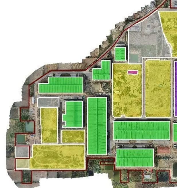
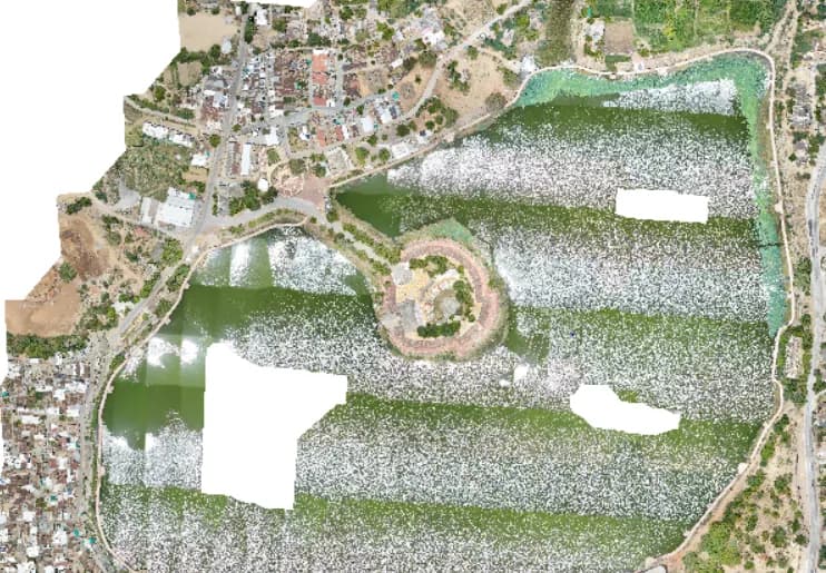
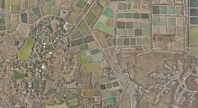
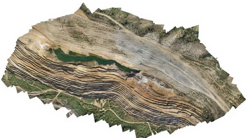
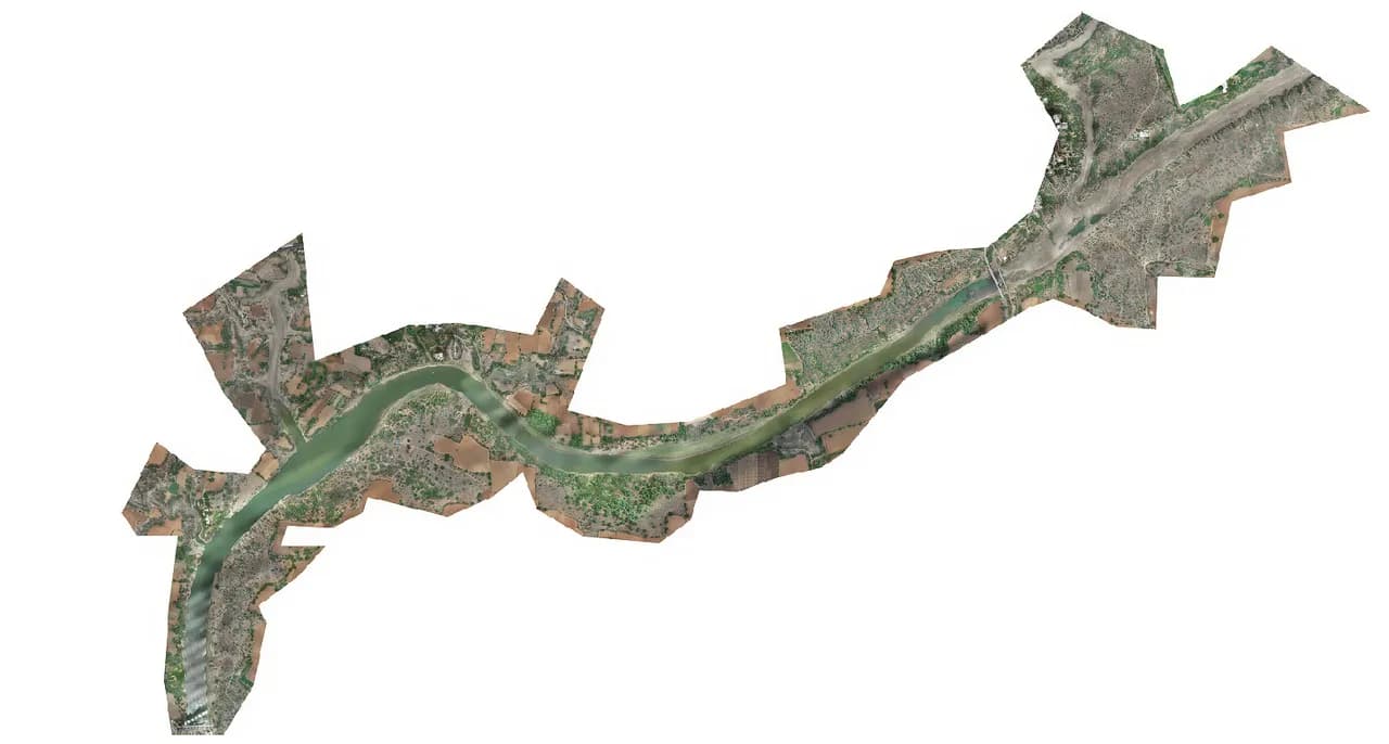
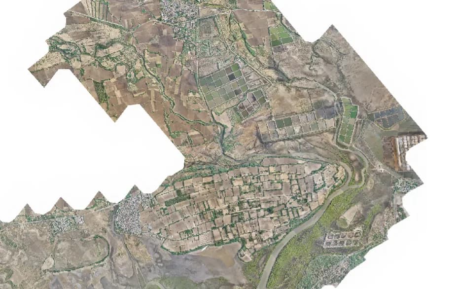
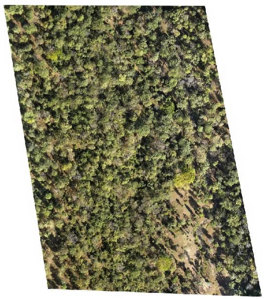
Ambaji Topographic Survey

Comprehensive drone survey and terrain modelling for accurate topographic assessment to support the Ambaji Walkway planning and design.

70 km²

Area surveyed

280

GCPs

99%

Accuracy

Deliverables

OrthomosaicContours (1 m)DSM & DTMCAD Drawings

Insight: High-accuracy terrain modelling enabled planners to identify elevation variations and optimize the alignment of the Ambaji Walkway with confidence.

Outcome: Achieved 99% survey accuracy and delivered complete datasets within 12 days, accelerating project planning and decision-making.

Reliance Multi-site Monitoring deliverableInfrastructure
Gujarat · Maharashtra · Karnataka·5–20 ha / site

Reliance Multi-site Monitoring

Drone mapping and digital site monitoring across multiple locations to enable centralized access and management of infrastructure assets.

30 / mo

Sites

5–20 ha

Area / site

5

GCPs / site

Deliverables

OrthomosaicContours (1 m)DSM & DTMCAD Drawings

Insight: Centralized geospatial datasets let project teams remotely monitor multiple sites across Gujarat, Maharashtra and Karnataka from a single location.

Outcome: Reduced field visits, accelerated decision-making and improved operational efficiency with real-time access to project sites across India.

Vadnagar Town Survey deliverableInfrastructure
Vadnagar, Gujarat·20 km²

Vadnagar Town Survey

Large-scale urban drone survey and terrain mapping for detailed town planning and infrastructure development.

20 km²

Area surveyed

94

GCPs

4

Deliverables

Deliverables

OrthomosaicContours (1 m)DSM & DTMCAD Drawings

Insight: Detailed elevation and surface models supported accurate urban planning and infrastructure expansion strategies.

Outcome: Delivered high-resolution geospatial data that improved planning efficiency and reduced dependence on conventional field surveys.

Infrastructure
Gandhinagar, Gujarat·25 km corridor

Gandhinagar Riverfront

Drone-based topographic survey and terrain modelling for riverfront development and landscape planning.

25 km

Corridor length

40

GCPs

Gujarat

State

Deliverables

OrthomosaicContours (1 m)DSM & DTMCAD Drawings

Insight: Accurate terrain and elevation information helped engineers understand slope patterns and optimize the riverfront design.

Outcome: Enabled faster planning and reduced survey timelines while maintaining engineering-grade accuracy.

Navsari Infrastructure Survey deliverableInfrastructure
Navsari, Gujarat·6 km²

Navsari Infrastructure Survey

Drone survey and terrain analysis for infrastructure planning and development.

6 km²

Area surveyed

4

Deliverables

Gujarat

State

Deliverables

OrthomosaicContours (1 m)DSM & DTMCAD Drawings

Insight: Generated precise terrain models for better planning and execution of infrastructure projects.

Outcome: Reduced survey time and improved planning accuracy using drone-based mapping.

Hydrology
Bavla, Gujarat·450 km²

Bavla Flood Mapping

Large-scale drone mapping and hydrological analysis for flood-risk assessment and watershed planning.

450 km²

Area surveyed

1,212

GCPs

Gujarat

State

Deliverables

DSM & DTMOrthomosaicWatershedFlood-prone AreasStream Orders

Insight: Terrain analysis identified natural drainage patterns and flood-prone zones critical for flood-mitigation planning.

Outcome: Delivered actionable flood-risk maps and watershed information to support long-term water-management strategies.

Hydrology
Lakhtar, Gujarat·2 km²

Lakhtar Hydrology & Drainage Study

Drone-based hydrological analysis to assess drainage patterns and flood susceptibility.

2 km²

Area surveyed

8

GCPs

Gujarat

State

Deliverables

DSM & DTMOrthomosaicWatershedFlood-prone AreasStream Orders

Insight: Micro-terrain analysis revealed water-accumulation zones and inefficient drainage channels.

Outcome: Identified flood-prone areas and supported effective drainage planning.

Kutch District 25 Dams deliverableHydrology
Kutch, Gujarat·25 dams

Kutch District 25 Dams

Data processing and hydrological analysis for reservoir-capacity assessment and siltation studies.

25

Dams analyzed

5

Deliverables

Kutch

District

Deliverables

DSM & DTMOrthomosaicWatershedFlood-prone AreasStream Orders

Insight: Detailed terrain and reservoir analysis quantified silt deposition and erosion trends across multiple dams.

Outcome: Generated volume-capacity tables and siltation assessments to support reservoir management and maintenance planning.

Navsari Hydrology Study deliverableHydrology
Navsari, Gujarat·64 km²

Navsari Hydrology Study

Drone mapping and hydrological analysis to support water-conservation planning.

64 km²

Area surveyed

242

GCPs

Gujarat

State

Deliverables

DSM & DTMOrthomosaicWatershedFlood-prone AreasStream Orders

Insight: Monsoon water-accumulation patterns highlighted ideal locations for future check dams and water-conservation structures.

Outcome: Enabled informed decision-making for check-dam placement and sustainable water-resource management.

Dalmia Mines, Meghalaya deliverableMining
Meghalaya·5 km²

Dalmia Mines, Meghalaya

Drone survey and mine terrain analysis for operational monitoring and statutory compliance.

5 km²

Area surveyed

25

GCPs

Meghalaya

State

Deliverables

OrthomosaicDSM & DTMContoursVolume Calculations

Insight: High-resolution terrain models enabled accurate monitoring of excavation progress and compliance with mining regulations.

Outcome: Reduced survey time significantly while providing precise datasets for IBM reporting and mine planning.

Mining
Gujarat·20 km²

Nirma Mines

Drone mapping and terrain analysis for production monitoring and resource management.

20 km²

Area surveyed

100

GCPs

Gujarat

State

Deliverables

OrthomosaicDSM & DTMContoursVolume Calculations

Insight: Drone-derived datasets improved stockpile monitoring, excavation planning and regulatory reporting.

Outcome: Delivered accurate mine measurements faster than conventional surveys, improving operational efficiency.

Solar
Gujarat·12 km²

Mahindra & Mahindra Solar

Drone mapping and terrain analysis for solar-farm planning and construction monitoring.

12 km²

Area surveyed

4

Deliverables

Gujarat

State

Deliverables

OrthomosaicDSM & DTMContoursCAD Drawings

Insight: Accurate terrain and surface models helped optimize panel layout, drainage planning and construction activities.

Outcome: Improved site-planning efficiency and reduced project-execution risks through high-resolution geospatial data.

Solar
Kutch, Gujarat·24 km²

Adani Solar Park

Large-scale drone survey and terrain mapping for solar-infrastructure development.

24 km²

Area surveyed

Kutch

Location

High-res

Terrain model

Deliverables

OrthomosaicDSM & DTMContoursCAD Drawings

Insight: Detailed terrain analysis enabled optimized solar-panel placement and efficient site grading.

Outcome: Accelerated planning and construction activities while maintaining engineering-grade accuracy.

Sabarmati Ring Road to Sanand deliverableTransmission
Ahmedabad, Gujarat·110 km corridor

Sabarmati Ring Road to Sanand

Drone corridor survey for transmission-line route planning across diverse terrain conditions.

110 km

Corridor length

75%

Time saved

Route survey

Application

Deliverables

OrthomosaicDTMContoursCAD Drawings

Insight: Drone technology enabled safe and efficient surveying in difficult and inaccessible terrain.

Outcome: Reduced survey time by 75% while delivering highly accurate route-alignment data.

Diu Rajapara LiDAR Mapping deliverableLiDAR±4 cm
Diu·20 km²

Diu Rajapara LiDAR Mapping

LiDAR data acquisition and terrain modelling for high-precision surface analysis.

20 km²

Area surveyed

22

GCPs

±4 cm

Accuracy

Deliverables

LiDAR Point CloudDTMDSMContours

Insight: LiDAR captured highly detailed terrain information and performed 45% more efficiently than conventional photogrammetry.

Outcome: Achieved 4 cm terrain accuracy while reducing survey time by 75%.

Dang Forest Survey deliverableForestry±3 cm
Dang, Gujarat·8 sites

Dang Forest Survey

LiDAR-based forest terrain mapping and GIS analysis for soil-moisture conservation planning.

8

Sites surveyed

80 m

Terrain variation

±3 cm

Accuracy

Deliverables

LiDAR Point CloudDTMSlope AnalysisTerrain Models

Insight: Advanced GIS analysis identified the most suitable locations for soil-moisture conservation structures in dense forest and highly variable terrain.

Outcome: Mapped terrain beneath dense vegetation with 3 cm accuracy, enabling precise environmental planning and sustainable watershed management.

Have raw survey data? Let's turn it into intelligence.

Send us your drone or survey data and receive engineering-grade deliverables, typically within 48 hours.